Chris and I in the Dual Cab, David in the Jeep and Trish and James in the Prado left O’Shannessey Park just after 8am, as planned, and headed South to Calliope where we met up with Bill in his Pajero. From there we headed for the Service Station South of Miriam Vale to refuel some of the vehicles. After refuelling, we hit the road for the rest area at Granite Creek, where we stopped for morning tea.
After coffee and cake, we headed back up the highway to the Granite Creek Forestry Road Bulburin National Park
Before stopping for lunch we drove down one of the side tracks to the small earthen dam, which supplied water to the camp and another campsite a short distance away. When we tried to drive back to the camp by the circuit we found our path blocked by a recently fallen tree. After retracing our steps we stopped at the Forestry camp for lunch.
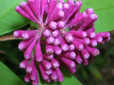
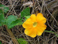
During our lunch break we took pictures of some of the plants, and visited what we originally thought was a lone grave of an 11 year old Eugenia Wilson. On closer inspection of the picture we took, Chris later identified it as Eugenia wilsonii which is the scientific name for Dabugay (a native edible fruit).
After lunch we drove down the mountain through Builyan and Many Peaks Childs Road Dawes National Park
After putting on boots, and grabbing water bottles and cameras, we headed off to visit the site of the Lady Inez Mine and smelters. Here, the two standing brick smelter chimneys and associated pits, brick and stone walls still remain amongst the encroaching vegetation.
On the slope behind the first chimney, you can find the remains of a steel hopper and skip, what appears to be an early type of water-jacket boiler, water pipes, flat pulleys on shafts, and various pieces of machinery. What remains of the rusting water jacketed boiler lies on its side amongst the brick and concrete ruins of engine beds and a brick flue can be found close to the Smelter 2 site. Fallen leaves help conceal the slag heaps near the chimneys and several mullock heaps are easily visible amongst the trees.
On the slope behind the first chimney, you can find the remains of a steel hopper and skip, what appears to be an early type of water-jacket boiler, water pipes, flat pulleys on shafts, and various pieces of machinery. What remains of the rusting water jacketed boiler lies on its side amongst the brick and concrete ruins of engine beds and a brick flue can be found close to the Smelter 2 site. Fallen leaves help conceal the slag heaps near the chimneys and several mullock heaps are easily visible amongst the trees.
From the smelters we continued onto what remains of the open cut mine and underground mine. Here National Parks has erected a Biological Hazard sign to warn of the dangers of Histoplasmosis from the bat guano. From there we followed tracks up the slope to inspect a couple of mine shafts.
From the shafts we took a different track to look at a large pool of water nestled between the rock faces of Coppermine Creek. Not far down the creek we stopped to sample the wild raspberries before returning to the campsite. Here we walked along the edge of the slope to inspect what I believe to be the numerous campsites of the early miners who dug out small areas on the sloping land to erect their shanties or tents.
Soon after, we joined Trish and James for happy hour. After cooking and eating our meals we sat around the campfire before retiring for the night.
Just after the full moon dawn David and I set off to find the Blue Bag mine. At first we climbed the hill at the top of the Lady Inez Mine, and after working out that the contours did not seem to fit the description of its location, decided to walk up the track towards Monto to see if we could find any tracks leading down. On reaching the gate at the top of the mountain we returned to camp to pack up.

 A bit after our return, Chris and I went for a walk along a spur the opposite side to the smelter and found what remained of house stumps and tank stands. Further on we found the remains of a standing metal and brick house chimney beside the creek. I returned to camp to collect the rest of the group and pick up the GPS to mark the location.
After packing up we drove back down the creek to find the location of Glassford township. I had worked out its location using Google Maps and Google Earth, prior to the trip, and calculated it to be about 1.8 km from the mango tree. We found it first try, and walked through the gate to look at the well and what remains of a windmill and old house stumps.
From here we had a couple of attempts before finding the track up to the Chinese Gardens Many Peaks
We then drove to Ubobo where we enjoyed morning tea in the shade behind the hall, and visited the toilets (which have been built using the Community Gaming Benefit Fund).
 From Ubobo we managed to contact Peter who was waiting for us near Kroombit Tops Lookout. Peter was able to watch us through his binoculars as we drove along the dirt road to meet him at the Lookout.
After lunch we drove to the carpark near Beautiful Betsy before donning boots and packs and heading off to the gorge and waterfall. On leaving the firebreak, we forced our way down the creek through the regrowth to the ledge at Annie Creek
Kroombit Falls
 From the pool, we walked back a short distance before climbing up a rock wallaby track to the top of the small gorge to take pictures of the smaller falls and gorge. We returned to the fire trail by forcing our way through the undergrowth beside the gorge. Once back at the car we had a cuppa and afternoon lunch before heading off by the bypass road past The Wall.
It has been just over two years since I was last on that track, and it has suffered more damage and erosion since then. With our limited articulation, picking the correct line was important, and at one point, where I needed two attempts in the Dual Cab to climb a rock pile on a slope, Bill followed a different line which resulted in a rock rolling slightly and the Pajero coming to rest on its cross-member on the edge of the track. Peter was able to pull him back slightly, and David pulled him up out of trouble after engaging the lockers on his Jeep. There were a couple of places further on just after a couple of crests where the wheels unexpectedly dropped into hollows and the bouncing car lifted us out of our seats.
It is unfortunate, but, if National Parks is unable to find the money to do some repairs to some of the sections of this track than I expect it will go the way of other 4WD tracks and be closed for our safety…!
On reaching the road we headed down off Kroombit Tops towards Calliope. I must have damaged the left rear tyre on the track as I was forced to stop and change it towards the bottom of Tableland Road
I enjoy going to places and having a good look around and for me this is why I became a member of the club. Chris and I enjoyed the company and would like to thank all participants for helping to make it a fantastic trip for us.
I find deserted towns fascinating as they can offer a window into our history and I intend to revisit the Dawes National Park
For more information on Glassford and the mines, go to:
Darryl


No comments:
Post a Comment